General information

Konin County embraces the territory situated in central Poland, at the eastern border of Wielkopolska Voivodeship. It takes up the area of 1.578 km2, which makes it the fourth biggest county in the Voivodship and marks it as one of the largest counties in Poland as a whole.
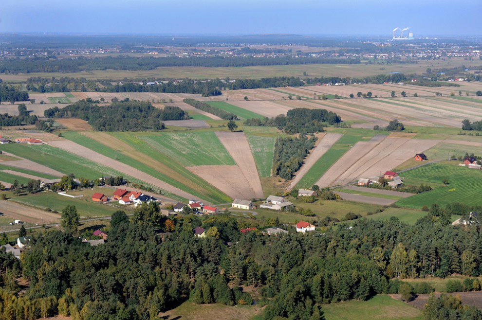
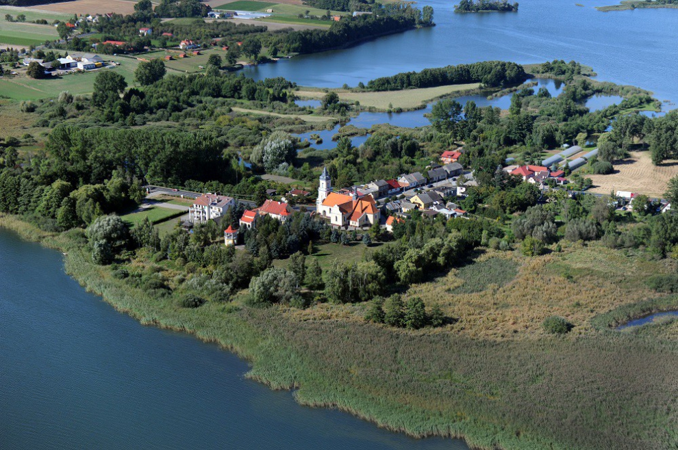
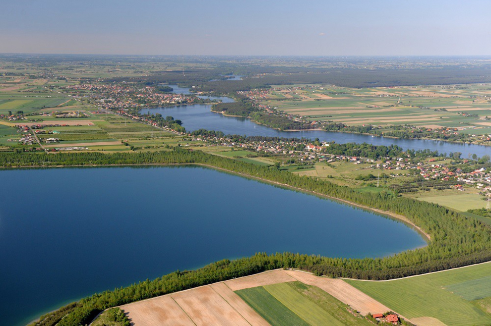
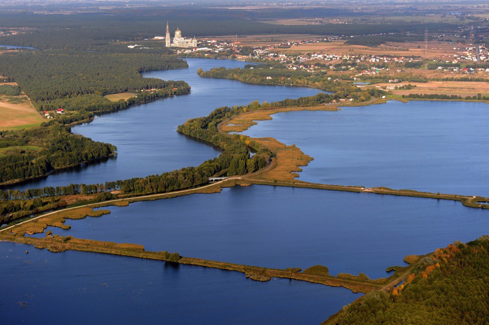
The territory of the county belongs to a strip of lowland within the limits of the Greater Poland Lowlands. In the central part of the county, there spreads the wide Warta Valley. In the part up north and down south from Warta, there are diverse uplands, additionally enhanced by 23 glacial lakes in the north:
- In the north-west part of the county: Wilczyńskie, Budzisławskie, Kownackie, and partially Wójcińskie, Suszewskie;
- In the Bieniszew forest complex: Głodowskie, Mielno, Wściekłe, Skąpe;
- A string of lakes to the north of Konin: Wąsosko-Mikorzyńskie, Ślesińskie, Licheńskie, Czarne, Mielno, partially Gopło and Skulskie, Skulska Wieś and Czartowo;
- In the middle-east part of the county: Lubstowskie, Mąkolno, Mostki, Szczekawa, and Zakrzewek.
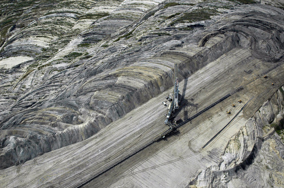
The climate is moderate, with mild winters and a low yearly level of atmospheric precipitation. The territory of the county is poor in useful natural resources. The most profitable resource is brown coal, whose deposits are located to the north from Konin City.
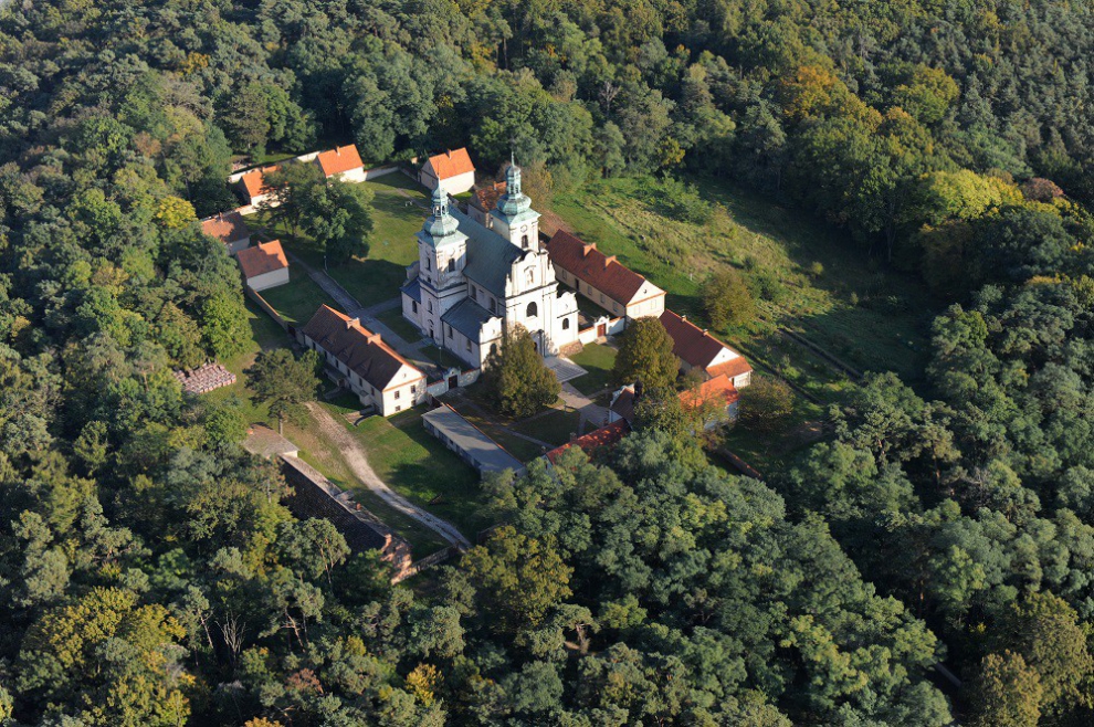
Forests occupy about 25000 ha, or 16,37% of the whole area. On the territory of the county, there are 63 natural monuments. Among the natural scenery, there are a few protected areas: Warta River Valley, the forest complex to the southeast from Konin City, Bieniszew Primeval Forest, as well as Gopło Lake and Skulskie Lakes surroundings.
Konin County includes 14 communes:
- 5 rural-urban communes: Golina, Kleczew, Rychwał, Sompolno, Ślesin;
- 9 rural communes: Grodziec, Kazimierz Biskupi, Kramsk, Krzymów, Rzgów, Skulsk, Stare Miasto, Wierzbinek, Wilczyn.
They are divided into 295 village councils. The local community inhabits 488 rural and 5 urban places. Konin County's population measures at (according to data from the end of 2019) 130,053 residents. Ślesin commune has the largest number of inhabitants (14 067), while the smallest in this regard is Grodziec county (5 160). The biggest town when it comes to the number of residents is Golina (4,478). The population of the rural territories makes up 86,41% of the whole county population.
At the end of 2019, within the whole population, the persons of pre-productive age made up 16,09% (20.92 thousand), and people of productive age made up 66,02% (85.864 thousand).
At the end of the 1st quarter of 2020, there were 3.963 thousand people that had registered as unemplyees. The biggest group amongst them (31,77%) were the persons ages 25-34 years old. The unemployment rate was measured at 8.9%. Within the whole number of people registered as unemployed, 12,77% had higher education; 22,81% were graduates of post-secondary and secondary vocational education; 10,35% had general secondary education; 29,60% were graduates of basic vocational schools; and 24,48% were graduates of primary schools.
Source: Powiatowy Urząd Pracy w Koninie
The local labor market, in regard to demand (number of job places), forms its two sectors: agriculture and fuel-energy complexes, along with their economic entities.
Shares of particular branches in the economic structures of communes are on a similar level with the county-wide ones. There is a noticeable dominance of the trade and repair service sector. In other sectors, there appear to be greater differences, but deviations from the average rate are of some percent at maximum (for example, in Ślesin commune, it concerns the hotel and catering industry, transport and warehousing, and in Golina and Sompolno communes, building industry).
Konin county, like other units of the Konin sub-region (the territory is almost the same as the one of the former Konin Voivodeship), despite the negative impact of the fuel-energy complex, is marked by a relatively large area of so-called high-value natural territories and areas that include elements of ecological structures.
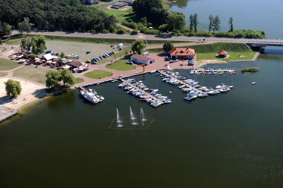
Such features of Konin County as geographic location, clear natural environment, route of lakes along with forest complexes, historic objects, and protected areas make this region attractive for the development of tourist services.
Exceptional virtues of Konin County make the basis for establishing such forms of tourism as:
- water tourism (canoeing, sailing, rowing, windsurfing, water skiing),
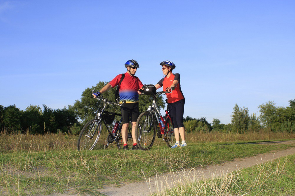
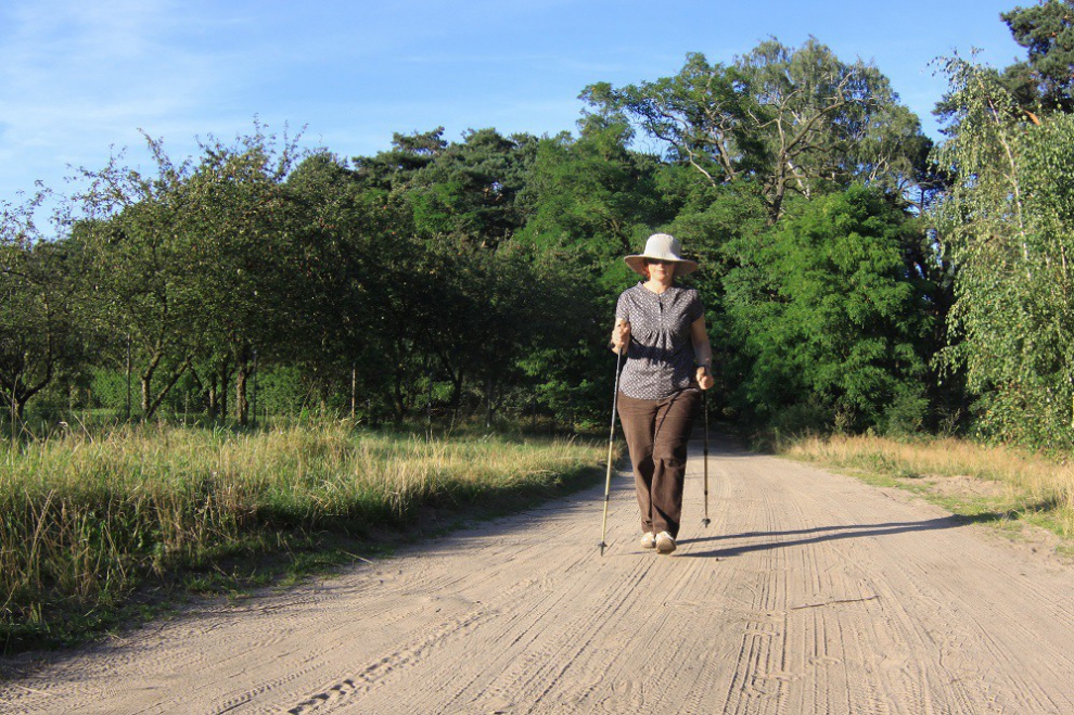
- hike and bicycle tourism,
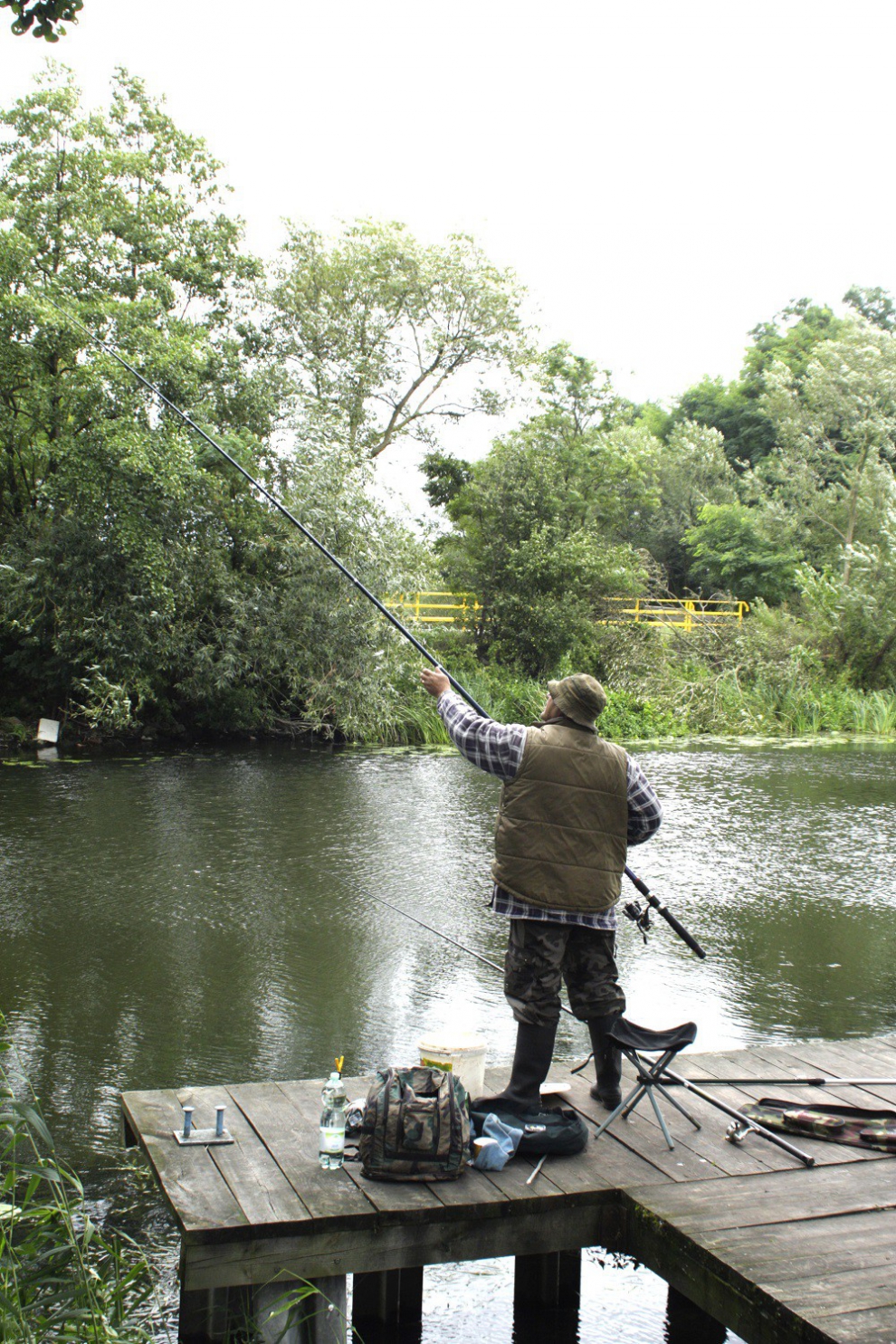
- fishing.
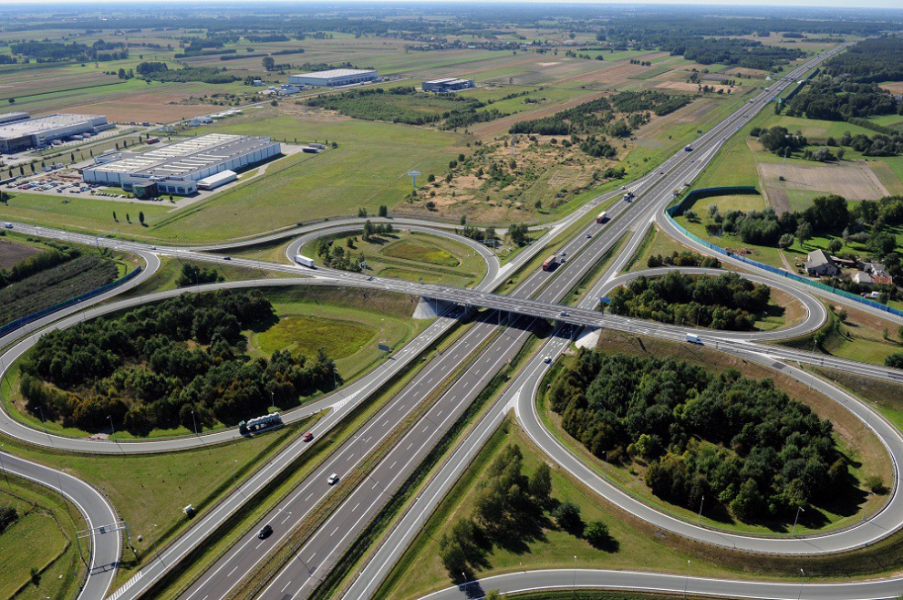
The central location of Konin County offers favorable conditions in regard to communication availability. It is a very important feature for the tourist sector. Easy access is crucial when it comes to forming the tourism structures within this territory. Besides the routes and means of transport, the communication base of Konin County also includes marked-out hike, bicycle, and kayak trails.
Tourist accommodations in Konin County mainly consist of hotels, conference and holiday centers, summer resort houses, chalets, camping sites, wayside inns, private lodgings, and agri-tourist farms.
On the territory of Konin County, all the recreation venues and hotels focus their attention on the development of sport-recreation equipment foundation.

(read more)
The district is situated in an area with a temperate climate with mild winters and low annual precipitation. The territory of the poviat is poorly equipped with useful natural resources. The greatest exploited wealth is lignite, the deposits of which are located north of Konin.
Forests in total cover over 25 thousand. ha and constitute over 16% of the total area. The natural and landscape values of the poviat's natural environment include protected areas: the Warta River valley, a forest complex to the south-east of Konin, the Bieniszewska Primeval Forest and the vicinity of Gopło Lake and Skulskie Lakes.
The territory of the Konin County includes 14 municipalities:
- 5 urban-rural communes: Golina, Kleczew, Rychwał, Sompolno, Ślesin;
- 9 rural communes: Grodziec, Kazimierz Biskupi, Kramsk, Krzymów, Rzgów, Skulsk, Stare Miasto, Wierzbinek, Wilczyn.
They are divided into 295 village councils. The local community is inhabited by 506 towns, including 5 towns.
The capacity of the Konin poviat (as at the end of 2019) had 130,053 inhabitants. The largest population of inhabitants is in Ślesin commune (14,067), while the smallest - in Grodziec commune (5,160). The largest city in terms of the number of inhabitants is Golina (4,478). The population living in rural areas constitutes 86.41% of the total poviat population.
At the end of 2019, in the general population of the population, people in pre-working age constituted - 16.09% (20 920 thousand), in working age - 66.02% (85 864 thousand) and in post-working age 17.89% (23 269 thousand).
The number of registered unemployed in the poviat at the end of Q1 2020 was 3,963 people. The largest group - 31.77% were unemployed aged 25-34. The unemployment rate was 8.9%. Of the total number of the unemployed, 12.77% were people with higher education; 22.81% with post-secondary and secondary vocational education; 10.35% with general secondary education; 29.60% with basic vocational education; with lower secondary education and less 24.48%. Source: Poviat Labor Office in Konin
The Konin County, similarly to the other areas of the Konin subregion (the territory almost identical to the area of the former Konin Province), despite the negative impact of the fuel and energy complex, is characterized by a relatively large area of the so-called areas with the highest natural values and areas with elements of ecological networks.
Such features of the Konin County as: geographical location, clean natural environment, a series of lakes with forest complexes, historic buildings and protected areas make it an attractive area for the development of tourist services.
The specialist qualities of the poviat's territory constitute the basis for the development of such forms of qualified tourism as:
- water tourism (canoeing, sailing, rowing, windsurfing, water skiing);
- hiking and biking;
- fishing.
The central location of the poviat creates favorable conditions in terms of transport accessibility. It is a very important feature for the tourism sector. Easy access is conducive to the formation of tourist traffic in a given area and has many benefits. Apart from roads and means of transport, the communication base of the Konin poviat also includes marked hiking, cycling and canoeing routes.
The accommodation base of the Konin poviat consists mainly of hotels, conference and recreation centers, summer cottages, camping houses, campsites, inns, private lodgings and agritourism farms. In the poviat, there is a developed base of sports and recreational facilities, which are equipped with conference and recreation centers and hotels, and to a lesser extent a base of paratourism services and entertainment services.